Listed Building

The only legal part of the listing under the Planning (Listing Buildings and Conservation Areas) (Scotland) Act 1997 is the address/name of site. Addresses and building names may have changed since the date of listing – see 'About Listed Buildings' below for more information. The further details below the 'Address/Name of Site' are provided for information purposes only.

Address/Name of Site

Dunure Limekiln, excluding 12 Castle Road, DunureLB52632

Status: Designated

Documents

Where documents include maps, the use of this data is subject to terms and conditions (https://portal.historicenvironment.scot/termsandconditions).

Summary

Category
C
Date Added
22/04/2025
Local Authority
South Ayrshire
Planning Authority
South Ayrshire
Parish
Maybole
NGR
NS 25370 15860
Coordinates
225370, 615860

Description

A large, early 19th century, stone two-draw limekiln built into the gradient of a steep bank between the coast and Castle Road, the main road through Dunure Village. The three visible sides of the kiln are built with a batter in random rubble with large rough-hewn quoins to the corners. The northwest elevation has two segmental arched openings at ground level which both have inner arches and vent holes. There are some small areas of brick repairs to the side walls at high level and a later rounded cope and small railing has been built around the top of the wall.

Historical development

This large kiln with paired single-draw kilns is situated above the harbour at Dunure, with the top at the level of and adjacent to the former coastal road from Ayr to Girvan. The double kiln first appears on the first edition Ordnance Survey Map (surveyed 1856, published 1858) and is also shown on the subsequent 1894 and 1908 maps.

The local Kennedy family estate built Dunure Harbour and its lighthouse in 1832 (Ordnance Survey Name Books). The harbour was built to land coal to serve the estate and wider area but its depth proved unsuccessful for the purpose and the lighthouse was never lit. The limekiln is thought to have been built in the early 19th century by the Kennedy's around the same time, or possibly just before, in order to supply lime for the harbour construction. The kiln is a "draw kiln” type which were typically constructed against the sloping ground, with draw openings on the front face where the lime was collected at the end of the limestone burning process. The scale of the kilns also suggests that they were intended for long term use.

The lush pastures of Ayrshire were ideal for dairy farming however this type of land use removed calcium from the soil and created a subsequent demand for lime for agricultural purposes to help fertilise and counteract the natural acidity of the local soils.

Historical research does not confirm whether the kilns were built to produce lime for use in the harbour construction, lime for agricultural purposes on the estate, or for general commercial lime production. There is little or no evidence to suggest the kilns were in long term use and local knowledge suggests they may never have been lit.

In the earlier 20th century a building was built on top of the kiln and used as a shop. A small gabled section (shown in a Canmore photograph from around 1970) was replaced with the larger pitched roof extension in the later 20th century and the whole building was converted to a dwelling.

Statement of Special Interest

Dunure Limekiln meets the criteria for listing for the following reasons:

  • The limekiln's authentic material and structure is largely unaltered and its form therefore retains the interest in its design. The later multi-stage house on top of the kiln is visually separate from it and does not significantly affect the inherent character of the kiln.
  • The limekiln makes a strong contribution to the immediate setting of the village of Dunure and is intervisible with other historic structures such as the harbour and the scheduled castle and dovecot.
  • It is a large example of a limekiln and surviving kilns are a rare building type in this region of Scotland.
  • It makes a significant contribution to our understanding of the industrial heritage of the village and wider area, in particular the history of 19th century lime production and the use of its natural resources.
  • It makes a contribution to our understanding of the social history of working life and the industrial heritage of the village and wider area.

In accordance with Section 1 (4A) of the Planning (Listed Buildings and Conservation Areas) (Scotland) Act 1997 the following are excluded from the listing: the modern house which sits on top of the limekiln (12 Castle Road, Dunure).

Architectural interest

Design

The limekiln is a good example of a double kiln which retains almost all of its historic fabric including the well-crafted dressed stone segmental arches and the interior details of the draw holes. The design and construction of the kiln is on a substantial, commercial scale with large roughly shaped corner stones and finely sized rubblework to the main walls.

Although there is a later house built on top, the kiln remains in almost completely original condition with only minor brick repairs at the parapet level. The level of surviving fabric is rare when compared with many other disused limekilns in the area and Scotland as a whole, where the majority have suffered significant losses to the fabric after they became redundant.

Setting

The limekiln is large and monolithic in shape and is prominent within its immediate and wider setting. It is intervisible with the harbour which it may have been historically associated. It also forms a strong visual group with the scheduled Dunure Castle and Dovecot (SM6105) which are nearer to the shoreline immediately to its south. The structure sits above many of the houses in the village and overall it makes a very significant contribution to the setting of the 19th century coastal village.

Historic interest

Age and rarity

Limekilns were a very common industrial building type across Scotland in the 18th and 19th centuries where most local areas had at least one to produce lime. Lime was both a crucial component for mortar in construction and as part of the fertilisation and improvement of land for agriculture. The majority of kilns either fell into disrepair or were demolished after construction methods and materials changed in the 19th century and lime was no longer commonly used.

The Dunure limekiln is not associated with any ancillary limeworks structures or is known to have been used in any significant historical event or building project, however it is a well-preserved example of an industrial type of structure that had an important role in the local and regional economic trade in 19th century Scotland.

There are under 30 limekilns in Scotland that are listed in their own right and the majority of those are located in the east of Edinburgh. Those sited on the coast and associated with harbours are rarer and include the later 19th century Ard Neakie kilns (LB516) and Skateraw in East Lothian (LB7707) both of which are listed at Category B and are of a later date than Dunure. Most other known limekilns in Ayrshire are inland and have losses to fabric such that they are not complete to wallhead. Examples of limekilns that survive in their complete form are relatively rare in Scotland and Ayrshire particularly. This example at Dunure, on the coast with associated harbour, has significant historic interest for its building type.

References

Bibliography

TROVE ID: https://www.trove.scot TROVE ID 203117

Maps

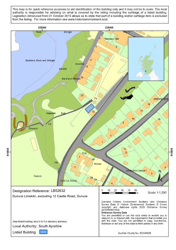
Ordnance Survey ( surveyed 56, published 1858) Ayrshire XXXVIII.6 ( with extension XXXVIII.2) (Maybole)

Printed Sources

Hume. J.R, (1976) The Industrial Archaeology of Scotland 1. The Lowlands and Borders, London: Batsford p.67.

Close. R and Riches. A, (2012) Buildings of Scotland, Ayrshire and Arran, Yale University Press, London p.315.

Online Sources

SCRAN, Lime Kilns, Castle Road, Dunure, South Ayrshire at https://www.scran.ac.uk/database/record.php?usi=000-000-555-536-C&scache=2qd68dvgwh&searchdb=scran [accessed 13/07/2023]

The Ordnance Survey Name Books Dunure at https://scotlandsplaces.gov.uk/digital-volumes/ordnance-survey-name-books/ayrshire-os-name-books-1855-1857/ayrshire-volume-46/31 [accessed 12/12/2023]

Other Sources

Information about the history of Dunure village and limekiln received from the proposer 2023.

About Listed Buildings

Historic Environment Scotland is responsible for designating sites and places at the national level. These designations are Scheduled monuments, Listed buildings, Inventory of gardens and designed landscapes and Inventory of historic battlefields.

We make recommendations to the Scottish Government about historic marine protected areas, and the Scottish Ministers decide whether to designate.

Listing is the process that identifies, designates and provides statutory protection for buildings of special architectural or historic interest as set out in the Planning (Listed Buildings and Conservation Areas) (Scotland) Act 1997.

We list buildings which are found to be of special architectural or historic interest using the selection guidance published in Designation Policy and Selection Guidance (2019)

Listed building records provide an indication of the special architectural or historic interest of the listed building which has been identified by its statutory address. The description and additional information provided are supplementary and have no legal weight.

These records are not definitive historical accounts or a complete description of the building(s). If part of a building is not described it does not mean it is not listed. The format of the listed building record has changed over time. Earlier records may be brief and some information will not have been recorded.

The legal part of the listing is the address/name of site which is known as the statutory address. Other than the name or address of a listed building, further details are provided for information purposes only. Historic Environment Scotland does not accept any liability for any loss or damage suffered as a consequence of inaccuracies in the information provided. Addresses and building names may have changed since the date of listing. Even if a number or name is missing from a listing address it will still be listed. Listing covers both the exterior and the interior and any object or structure fixed to the building. Listing also applies to buildings or structures not physically attached but which are part of the curtilage (or land) of the listed building as long as they were erected before 1 July 1948.

While Historic Environment Scotland is responsible for designating listed buildings, the planning authority is responsible for determining what is covered by the listing, including what is listed through curtilage. However, for listed buildings designated or for listings amended from 1 October 2015, legal exclusions to the listing may apply.

If part of a building is not listed, it will say that it is excluded in the statutory address and in the statement of special interest in the listed building record. The statement will use the word 'excluding' and quote the relevant section of the 1997 Act. Some earlier listed building records may use the word 'excluding', but if the Act is not quoted, the record has not been revised to reflect subsequent legislation.

Listed building consent is required for changes to a listed building which affect its character as a building of special architectural or historic interest. The relevant planning authority is the point of contact for applications for listed building consent.

Find out more about listing and our other designations at www.historicenvironment.scot/advice-and-support. You can contact us on 0131 668 8914 or at designations@hes.scot.

Images

Detail a draw hole in Dunure Limekiln, on clear day.
Dunure Limekiln, looking north during daytime, on clear day showing the house on top of the kiln.

Map

Map

Printed: 04/06/2026 09:11