Description
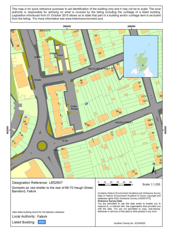
The building is a Second World War domestic air raid shelter, potentially a prototype built in the early months of the conflict. It is located at the northern end of the rear gardens of 68 and 70 Haugh Street in Bainsford, Falkirk.
The building is a brick and concrete structure, with gabled east and west ends and a pitched concrete roof. There is a single entrance at each gabled end of the building, and the remains of baffle walls that previously shielded the doors from blasts. Internally, the structure is divided into two rooms by a central brick wall, one for each residential property, with a low crawlspace in the central wall permitting access between them in an emergency.
Historical development
Six terraced houses including a house at 68 and 70 Haugh Street are shown on Ordnance Survey maps (surveyed 1938, published c.1948), and these houses remain on the site to the modern day. The air raid shelter is not visible on the 1938 Ordnance Survey map but appears to have been built in a single phase, within the first few years of the Second World War, as records indicate Falkirk Council were constructing brick shelters by late 1940, and as this example may be a prototype design it would likely have been among the earliest to be built.
Statement of Special Interest
The Haugh Street air raid shelter meets the criteria of special architectural or historic interest for the following reasons:
- The shelter is a rare and largely unaltered surviving example of a Second World War domestic shelter.
- The design of the shelter combines elements of both types of brick and concrete shelter used in the Falkirk area, making it a very rare design and suggesting it is potentially an earlier prototype or experimental design for the area.
- It retains its physical relationship with the two residential properties that it was constructed to serve.
- It is a tangible link to one of the defining events of the 20th century, the Second World War, and the impact that the conflict had on civilian populations and the Home Front.
Architectural interest
Design
The design of the building is very simple, prioritising function over form, and there are no notable decorative features in the structure. The concrete and brick used for the building are among the most common building materials for military and civilian structures relating to the Second World War.
The shelter appears to be of an unusual and very rare design within the Falkirk area. The use of above ground shelters was necessary in the Falkirk area, as attempts early in the war to make use of subterranean designs such as the Anderson shelter failed as the excavated trenches were invariably flooded by groundwater. By 1940-41, the Falkirk authorities were constructing two types of brick and concrete shelter for domestic properties. The Type 1 shelter comprised a long rectangular plan with a flat concrete roof, usually constructed in pairs to serve adjoining households, while the Type 2 used a square plan with a pitched concrete roof. The shelters built at Haugh Street appear to be a combination of the two types that is not found anywhere else within the area, suggesting they may be early prototypes or experimental designs.
Setting
The setting of the building has not drastically altered since the shelter was constructed during the Second World War. As the shelters were built at the ends of the rear gardens along Haugh Street, this meant the setting was restricted by the surrounding houses, and this remains the same today, with the only major change being the replacement of the original buildings at the western end of the street block with early 21st century residential apartments.
The survival of the shelter's physical relationship with the residential properties at 68 and 70 Haugh Street, which it was built to serve, does have some interest in listing terms.
Historic interest
Age and rarity
The building is an early and now rare surviving example of a formerly very common building type. During the Second World War, a wide variety of designs of air raid shelter were constructed and used. Due to the legal requirement placed on local authorities during the war, civil defence buildings and structures of this type would have been very common at the time.
There is no definitive total for the number of air raid shelters constructed within Britain during the Second World War, but they undoubtedly numbered in the millions; records show the manufacture of around 2.5 million of the "Anderson" model of shelter alone. Despite the vast numbers of air raid shelters originally built, however, only a tiny fraction of the total now survive, as subsequent demolition, deterioration and clearance have removed most examples.
Social historical interest
The building is a tangible link to the Second World War, and the wide-reaching impacts it had on civilian populations far from the frontlines. By the time of the Second World War, aerial warfare had developed to a level that could directly attack infrastructure, industries, and population centres far behind the front lines of the conflict, and new approaches to defence and protection were needed to combat them. This need for civil defence infrastructure to protect against enemy air attacks on the home front within Scotland marked a major shift from previous late 19th and early 20th century conflicts, and in the personal experience of those living through them within Scotland.
The necessity of civil defence, for the purpose of protecting the civilian population, had been realised following German bombing raids during the First World War, and was brought into harsh relief by the 1937 bombing of Guernica during the Spanish Civil War. Following the passing of the Air Raid Precautions Act in 1938 and the Civil Defence Act in 1939, local authorities were required to establish Air Raid Precaution (ARP) schemes for their areas. This included the creation of communal and domestic shelters, installation of warning systems, distribution of gasmasks and other equipment and for the organisation and running of an ARP Warden service.
The industrial nature of the Falkirk region, coupled with its proximity to the Rosyth naval base, made the area a prime target for potential attack, and documentary records indicate that active preparations were being made in the Falkirk area from at least 1938.
Association with people or events of national importance
The Haugh Street air raid shelter is directly connected to the Second World War, one of the most important and defining events of the 20th century. Extremely common during the war, civilian air raid shelters like this example were nonetheless a visible and necessary element of the conflict within Scotland, as the rapid development of aerial warfare in the early decades of the 20th century created the possibility of direct attack on infrastructure and populations far away from the front lines of the conflict.
References
Bibliography
TROVE ID: https://www.trove.scot TROVE ID 369299
Maps
Ordnance Survey (surveyed 1938, published circa.1948) Stirlingshire nXXIV.SE Six-inches to the mile, Southampton: Ordnance Survey
Ordnance Survey (surveyed 1943, published 1947) Stirlingshire nXXIV.15 25 inches to the mile, Southampton: Ordnance Survey
Printed Sources
Dobinson, C., 2000. Twentieth century fortifications in England Volume VIII civil defence in WWII: protecting England's civil population 1935-45. York: Council for British Archaeology.
'Iolana, P., 2022. The Discovery of a Unique WWII Domestic Air Raid Shelter. History Scotland, Vol. 22, No. 3, (May/June 2022), pp.10-13.
Walker, J., 2022. Falkirk at War 1939-45. Calatria: The Journal of the Falkirk Local History Society, Vol. 10 (Winter 1996), pp.93-102.
Online Sources
Thomas, R. and Stamper, P. (2016). Civil Defence: From the First World War to the Cold War. Historic England. Available at: https://content.historicengland.org.uk/images-books/publications/iha-civil-defence/heag145-civil-defence-iha.pdf [Accessed 06 May 2022].
About Listed Buildings
Historic Environment Scotland is responsible for designating sites and places at the national level. These designations are Scheduled monuments, Listed buildings, Inventory of gardens and designed landscapes and Inventory of historic battlefields.
We make recommendations to the Scottish Government about historic marine protected areas, and the Scottish Ministers decide whether to designate.
Listing is the process that identifies, designates and provides statutory protection for buildings of special architectural or historic interest as set out in the Planning (Listed Buildings and Conservation Areas) (Scotland) Act 1997.
We list buildings which are found to be of special architectural or historic interest using the selection guidance published in Designation Policy and Selection Guidance (2019)
Listed building records provide an indication of the special architectural or historic interest of the listed building which has been identified by its statutory address. The description and additional information provided are supplementary and have no legal weight.
These records are not definitive historical accounts or a complete description of the building(s). If part of a building is not described it does not mean it is not listed. The format of the listed building record has changed over time. Earlier records may be brief and some information will not have been recorded.
The legal part of the listing is the address/name of site which is known as the statutory address. Other than the name or address of a listed building, further details are provided for information purposes only. Historic Environment Scotland does not accept any liability for any loss or damage suffered as a consequence of inaccuracies in the information provided. Addresses and building names may have changed since the date of listing. Even if a number or name is missing from a listing address it will still be listed. Listing covers both the exterior and the interior and any object or structure fixed to the building. Listing also applies to buildings or structures not physically attached but which are part of the curtilage (or land) of the listed building as long as they were erected before 1 July 1948.
While Historic Environment Scotland is responsible for designating listed buildings, the planning authority is responsible for determining what is covered by the listing, including what is listed through curtilage. However, for listed buildings designated or for listings amended from 1 October 2015, legal exclusions to the listing may apply.
If part of a building is not listed, it will say that it is excluded in the statutory address and in the statement of special interest in the listed building record. The statement will use the word 'excluding' and quote the relevant section of the 1997 Act. Some earlier listed building records may use the word 'excluding', but if the Act is not quoted, the record has not been revised to reflect subsequent legislation.
Listed building consent is required for changes to a listed building which affect its character as a building of special architectural or historic interest. The relevant planning authority is the point of contact for applications for listed building consent.
Find out more about listing and our other designations at www.historicenvironment.scot/advice-and-support. You can contact us on 0131 668 8914 or at designations@hes.scot.
Map
Printed: 14/05/2026 10:11